Guide to Buying a River Access Home in Gruene
February 19, 2026
February 19, 2026
Have you pictured mornings on the Guadalupe where you launch a tube or cast a line from your own backyard? Buying in Gruene Cove and the surrounding Gruene corridor can give you that river lifestyle, but it also adds a few extra steps to protect your investment. In this guide, you’ll learn how river access really works in Gruene, what to verify about easements and riverbed rights, how flood zones and insurance affect costs, and which permits and inspections to line up. Let’s dive in.
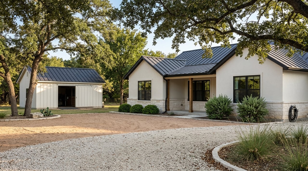
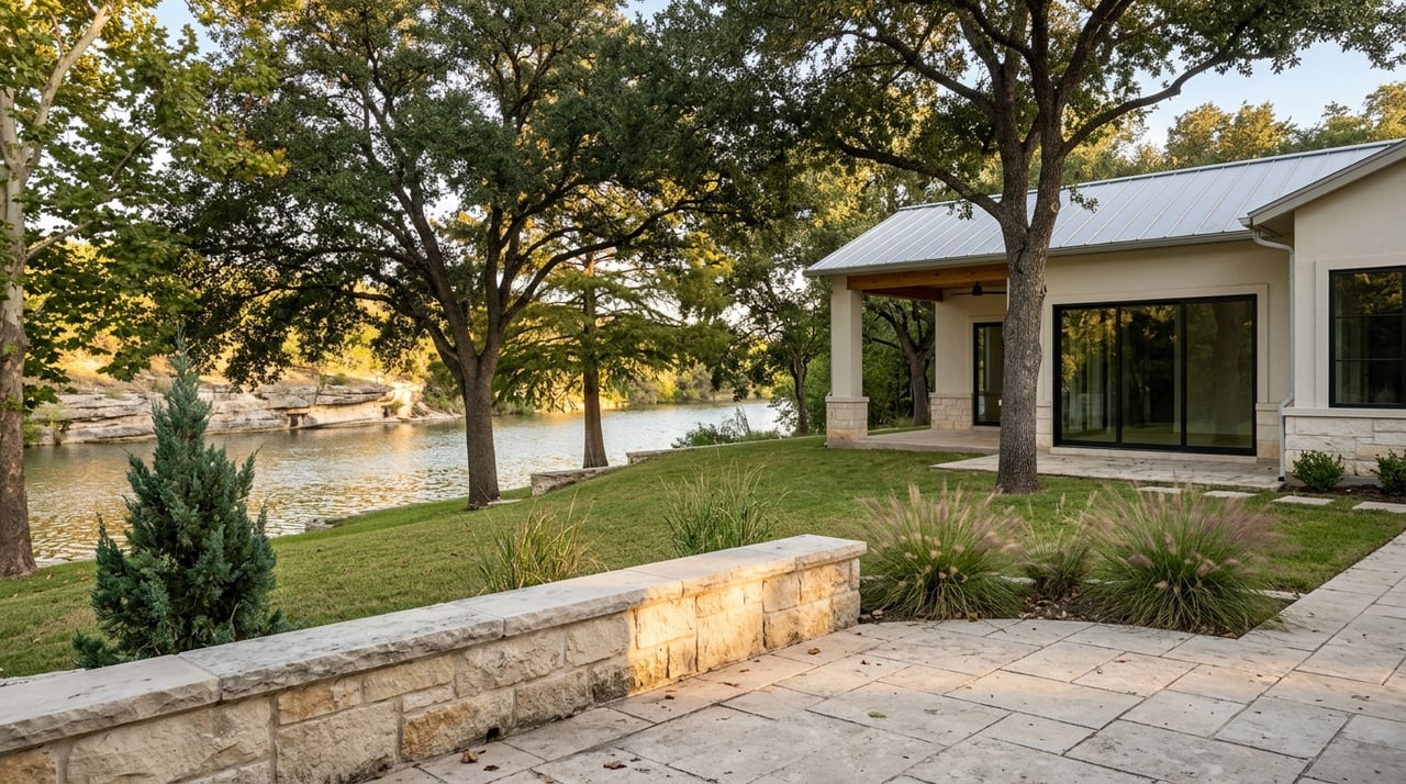
Gruene sits right on the Guadalupe and blends historic charm with outfitters, parks, and private homes. That mix creates a true river culture with floating, fishing, and relaxed evenings near the water. It also means conditions change by block and by season, especially on busy summer weekends.
Before you buy, spend time in the area on both a weekday and a peak Saturday. Pay attention to parking, river traffic, and noise patterns along your target stretch. You can also review local access points and river information on the Gruene visitor page to set expectations for how the corridor functions (learn more about river access and outfitters in Gruene).
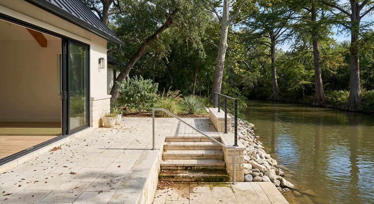
Not all river-oriented homes offer the same kind of access. In Gruene Cove and nearby pockets, you will typically see three setups.
Two rules of thumb help you avoid surprises. First, do not assume a visible trail equals legal access. Second, treat brochures as a starting point. Always verify the recorded easement instrument and restrictions before you fall in love with a property’s “river access” description.
Texas separates the right to use water from the ownership of the riverbed. On some streams that are considered navigable, the State may own the bed, which supports broader public use of the water. Even then, the public cannot cross private land to reach the water without permission. In short, public navigation does not grant crossing rights across a private bank.
Your title company or real estate attorney should review the deed and historical patents for any riparian reservations that could affect bed ownership or use. For a clear overview, see Texas Parks and Wildlife’s guidance on who owns riverbeds and what that means for access (read the TPWD overview).
Local enforcement also shapes day-to-day realities. The City and County actively monitor trespass, parking, and unsafe use in popular spots. Recent measures like fencing near higher-risk areas signal that rules are being enforced where needed (see a recent enforcement example). If you are considering a busy stretch, ask about neighborhood experiences and posted restrictions.
Flood considerations are the single biggest long-term factor for river properties. Start early with these checks so you understand buildability, carrying costs, and lender requirements.
Confirm which FEMA flood zone applies to the property and whether any part of the insurable building footprint lies in the Special Flood Hazard Area. Ask Comal County for a written floodplain determination and request any Elevation Certificate on file. If a lot touches the regulatory floodway, expect stricter limits on additions, fill, and certain improvements. You can reach the County’s floodplain program for parcel-specific guidance and permit steps (Comal County floodplain resources).
FEMA’s NFIP now uses Risk Rating 2.0. Premiums are based on structure-level factors like distance to the river, elevation, foundation type, and replacement cost, not only the zone on the map. If you have a federally related mortgage and the building is in an SFHA, the lender will require flood insurance. Mitigation and Elevation Certificates can influence pricing, so gather quotes early and compare options (NFIP Risk Rating 2.0 guidance).
If a structure sits above Base Flood Elevation, you may be able to remove the mandatory purchase requirement through a FEMA Letter of Map Amendment or Revision. This process relies on certified elevation data and takes time, so ask about feasibility during your option period (LOMA and local permit guidance).
The Guadalupe River downstream of Canyon Lake has seen major flood events. Before you commit, review historical flood information and any dam-release planning documents so you understand how high flows have behaved in past events. It is also helpful to ask neighbors about their own flood experiences and evacuation plans (Canyon Lake flood history and resources).
Riverfront ownership often includes ongoing care for banks and access structures. Plan proactively for what you can build, how you stabilize the bank, and when you need permits.
Common stabilization approaches range from vegetated buffers and bioengineering to rock toe protection or riprap. Some treatments can reduce long-term erosion, but many require permits and professional design. Before adding a dock, placing rock, or doing in-stream grading, contact the U.S. Army Corps of Engineers and check county requirements. Even small projects may need authorization under nationwide or general permits, so always confirm first (USACE regulatory program overview).
For background on stabilization methods, you can review conservation standards that outline options for stream banks and riparian buffers. These resources help you talk with engineers or contractors about durable, lower-maintenance designs that fit the site.
Parts of the New Braunfels and Comal area influence spring-fed systems with federally listed species and designated critical habitat. Projects that could affect springs or sensitive habitat may face additional biology reviews or consultations. If you plan near-water or in-water work, expect the permitting team to ask about environmental impacts and possible mitigation (federal habitat guidance overview).
Many Hill Country parcels rely on on-site sewage facilities and private wells. Ask for septic records, permit history, and the date of the last service. For wells, request water-quality testing and any available well logs. Comal County Environmental Health manages OSSF permits and maintains septic records, and they can guide you through inspections or upgrades during your option period (septic and well resources).
River access changes the rhythm of your day in great ways, but it also brings more visitors to the corridor during peak season. Visit at different times to gauge parking stress, tube traffic, and noise. If your access depends on a shared park or trail, confirm hours, guest policies, and how keys or passes are issued.
The City of New Braunfels maintains river information, rules, and resident pass details that can affect your routine. Reviewing these programs gives you a clearer view of how the community manages crowds and access points each season (city river rules and passes).
Use this list with your agent, title, lender, and inspectors. Many items should be obtained before or as contract contingencies.
Buying a river-access home involves more moving parts than a typical neighborhood purchase. You need clear answers on easements, floodplain status, and long-term maintenance before you commit. That is where local experience makes a difference.
Our team understands Hill Country river living and the permitting landscape around Gruene Cove and New Braunfels. We help you gather the right documents early, coordinate with the County floodplain office, and connect you with trusted inspectors and insurance resources. You get a calm, step-by-step process that protects your time and money while keeping your lifestyle goals in focus.
If you are ready to tour river-access options or want a second opinion on a property you found, connect with our team. Start the conversation with Sunrise Realty Group, and let’s map your next steps with confidence.
Stay up to date on the latest real estate trends.

We’d love to hear from you! Whether you’re buying, selling, or just exploring your options, we’re here to provide answers, insights, and the support you need. Contact us and start planning your next move.